Jump to content

Log in or register to remove this advert

Lidar uses in Arboriculture.


colemanjessenz
 Share

Recommended Posts

Log in or register to remove this advert

3 hours ago, Jon Heuch said:

I haven't checked the coverage of all of the UK but the EA (Environment Agency) has LIDAR surveyed England as far as I know.

I don't know what EA lidar data is available now but over ten  years ago I downloaded some to look at the old workings and three barrows on the local heath. It seemed to be aimed at determining local flood risk. At the time, on my non cutting edge Pentium PC it took ages to render an image. The data had already been processed to show the longest reflection,so tops of trees were filtered out, and only the ground surface was shown.

  • Like 1
Link to comment
Share on other sites

50 minutes ago, Mark Bolam said:

Are you at the 

55 minutes ago, Mark Bolam said:

Are you at the APF Jesse?


I don’t think I’ll be able to make it Mark. 
I’m flying back on the 22nd so it’s cutting it a bit close. 
 

Flick me a message on Facebook, I can keep ya updated. 


  • Like 1
Link to comment
Share on other sites

  • 1 month later...
Posted (edited)


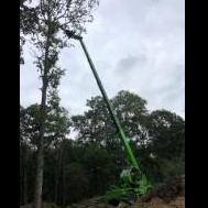
Here's a link for some of the recent work we’ve been doing. This job is not my own, it’s for a friend. He’s asked me to consult and to dust off the harness if it goes ahead.
Great to use our scanner on, we will be extracting a lot of information from this one. 


Edited by colemanjessenz
  • Like 2
Link to comment
Share on other sites

8 hours ago, colemanjessenz said:


Here's a link for some of the recent work we’ve been doing. This job is not my own, it’s for a friend. He’s asked me to consult and to dust off the harness if it goes ahead.
Great to use our scanner on, we will be extracting a lot of information from this one. 


The description for those that don’t go through to YouTube. 
 

@KōwhaiAero helping out on a site proposed for #helicopter extraction. Using lidar equipment and GIS software they were able to isolate the proposed trees for lifting and provide a site map for planning. This information can be shared remotely so the team can familiarize themselves with the site, create a plan, efficiently deliver required materials for each individual tree.

  • Like 2
Link to comment
Share on other sites

Create an account or sign in to comment

You need to be a member in order to leave a comment

Create an account

Sign up for a new account in our community. It's easy!

Register a new account

Sign in

Already have an account? Sign in here.

Sign In Now
 Share

  •  

  • Featured Adverts

About

Arbtalk.co.uk is a hub for the arboriculture industry in the UK.  
If you're just starting out and you need business, equipment, tech or training support you're in the right place.  If you've done it, made it, got a van load of oily t-shirts and have decided to give something back by sharing your knowledge or wisdom,  then you're welcome too.
If you would like to contribute to making this industry more effective and safe then welcome.
Just like a living tree, it'll always be a work in progress.
Please have a look around, sign up, share and contribute the best you have.

See you inside.

The Arbtalk Team

Follow us

Articles

×
×
  • Create New...

Important Information

We have placed cookies on your device to help make this website better. You can adjust your cookie settings, otherwise we'll assume you're okay to continue.